


A short walk counts. These city paths and suburban trails can help you find a manageable place to start.
About this researched guide
I ran track in high school, but I haven’t been running as much lately. That’s the perspective behind this guide. It’s for people starting out, getting back into it, or looking for a different place to take their usual walk.
Choose a route that fits today
Compare the setting, surface and practical limits. A shorter out-and-back is an option; you don’t have to finish a whole trail.
Walking and running routes in Philadelphia
Schuylkill Banks: a flexible riverfront outing

- Terrain & setting
- Riverfront path · Philadelphia
- For your walk or run
- Shared with bikes. Choose your own turnaround.
River views, with an outing you can shorten by choosing your turnaround.
Surface and setting: developed riverfront trail, shared with other users. The official map identifies access points including the South Street ramp and entrances around Center City.
Start at a convenient entrance and turn back while the return still feels manageable. There’s no need to complete a river loop.
Delaware River Trail: waterfront stops on the east side
- Terrain & setting
- Waterfront paths · Philadelphia
- For your walk or run
- Use pedestrian space. Check interim segments and crossings.
Waterfront stops on the city’s east side. Choose a specific segment before leaving.
Use the pedestrian sidewalk in the developed central section, not the separate bike path.
There are also interim trail segments and construction notices. This isn’t a promise of an uninterrupted, traffic-free run from one end of the waterfront to the other. Choose a specific segment, check pedestrian detours and crossings, and make that your outing.
Forbidden Drive: gravel beside the Wissahickon

- Terrain & setting
- Gravel · Wissahickon Valley Park
- For your walk or run
- Shared with bikes and horses. Expect uneven or muddy spots.
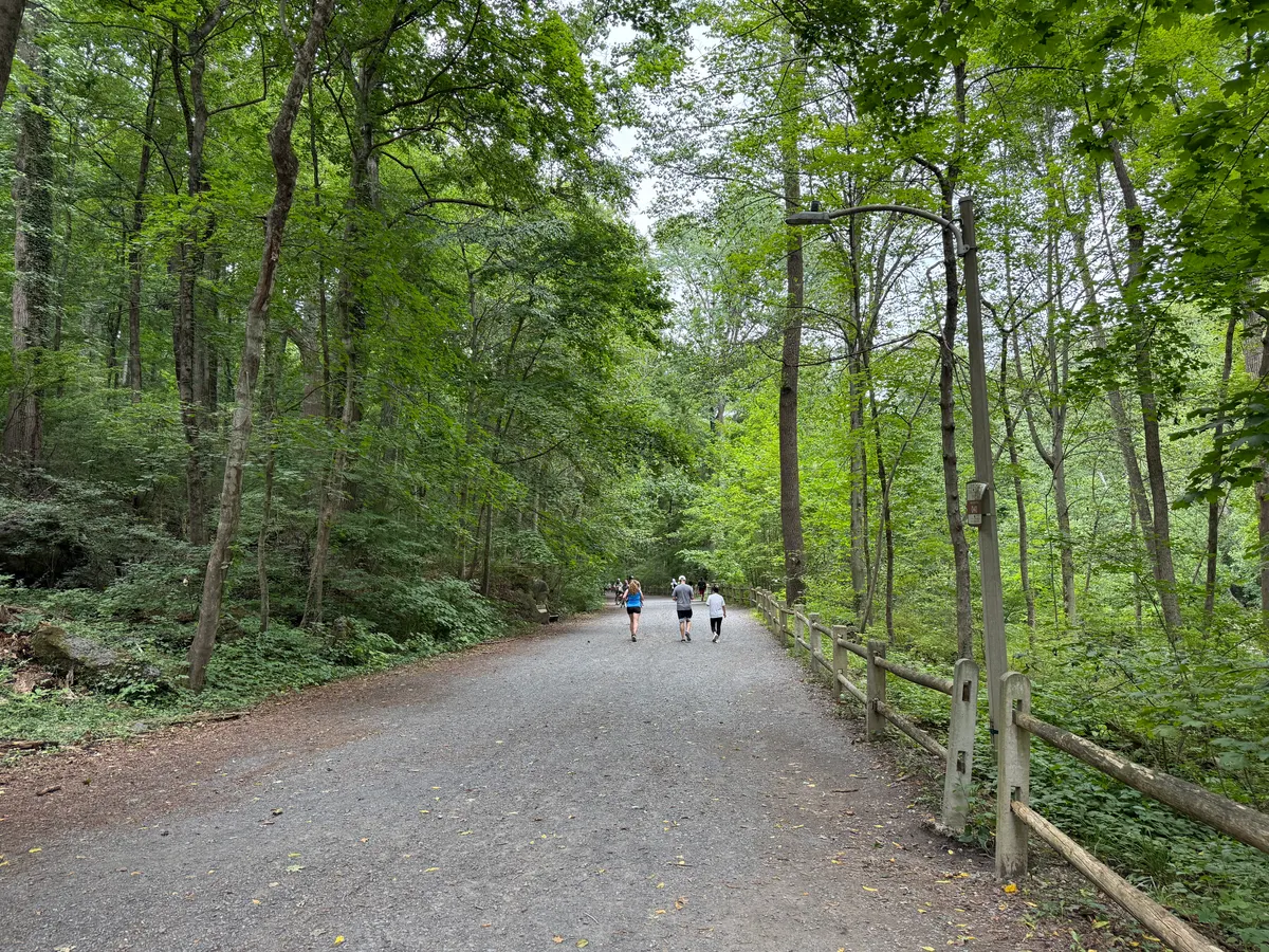
A wooded outing beside the Wissahickon, away from the upper hiking trails.
Surface and setting: a wide gravel corridor through Wissahickon Valley Park. Friends of the Wissahickon describes Forbidden Drive as a generally flat, five-mile route beside the creek, distinct from the steeper and rockier upper trails.
Use FOW’s maps and directions to choose an entrance and a shorter out-and-back. Check the approach from your entrance as well as the main creekside path.
Paths outside the city
Pennypack Trail: a Montgomery County rail-trail option

- Terrain & setting
- Crushed stone · Montgomery County
- For your walk or run
- Road and active rail crossings. Check access notices.
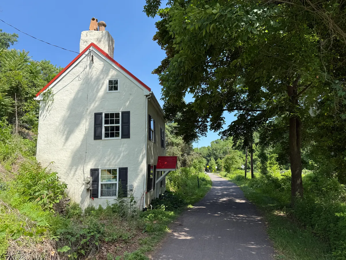
A Montgomery County rail trail for an adjustable out-and-back.
Rockledge Park is one starting option. Choose a segment and return the same way. This is the Montgomery County rail trail, not every path in Philadelphia’s Pennypack Park.
There are road crossings and an active rail crossing. Follow signals and gates. The county page also flags access restrictions around the Fetters Mill Road bridge, so check current instructions rather than assuming every approach is available.
Peace Valley Park: lake views in Bucks County

- Terrain & setting
- Paved lake loop · Bucks County
- For your walk or run
- The full loop is six miles. A shorter out-and-back is an option.
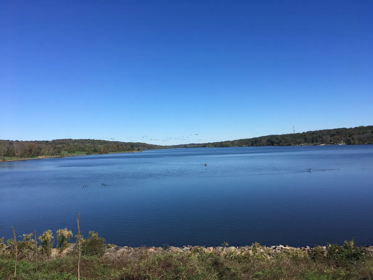
Lake views without having to commit to the whole circuit.
Six miles may be more than you want. Instead of committing to the lake circuit, choose a direction from your access point and retrace a shorter section. Look at the map before starting so you know which path you’re taking.
The paved loop and the nature paths aren’t the same outing. Check park notices and the weather, and don’t assume the route or facilities will suit every stroller or mobility need simply because part of the park is paved.
Valley Forge: a paved route with real hills

- Terrain & setting
- Paved five-mile loop · Valley Forge
- For your walk or run
- Steep sections and limited shade. Paved does not mean flat.
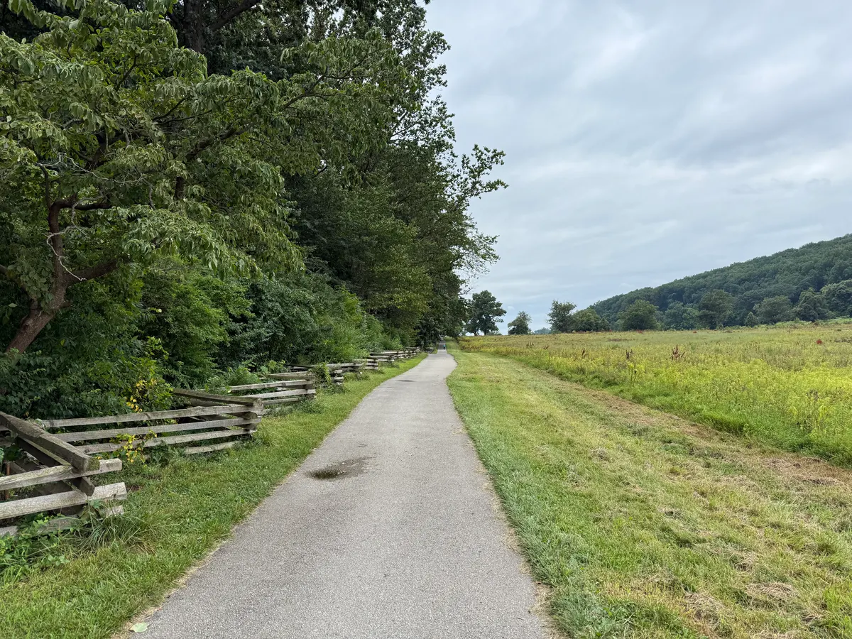
History and open views, with hills to factor into the way back.
The visitor center can help you get oriented. Pick a shorter return route if the full loop is too much, and allow for the hills on the way back.
Use the park’s current operating hours and alerts when planning. Don’t treat the loop as an all-hours training track.
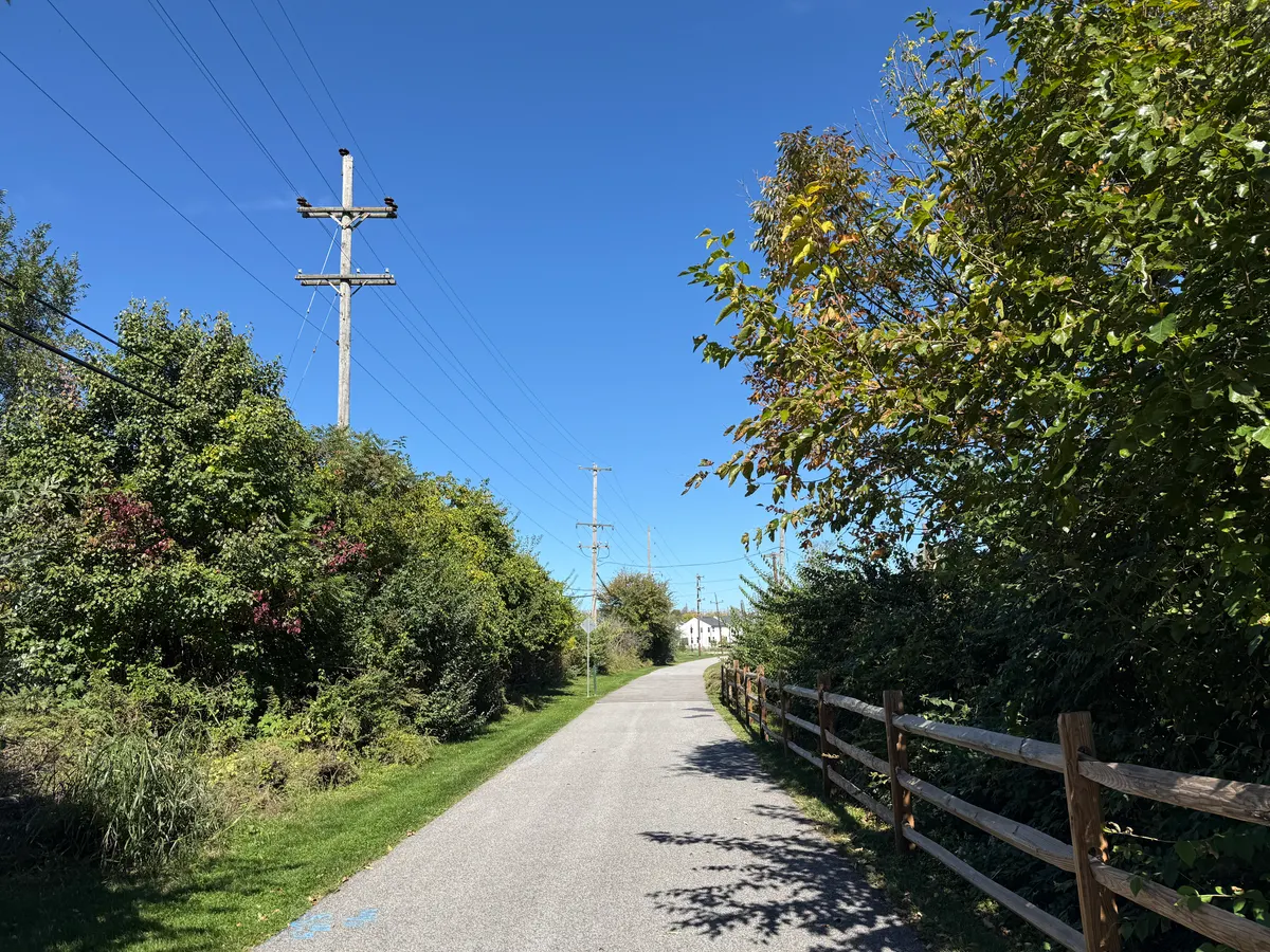
Chester Valley Trail: choose a convenient trailhead

- Terrain & setting
- Asphalt · Chester and Montgomery counties
- For your walk or run
- Check crossings, posted hours and weather restrictions.
Start with a convenient entrance rather than the full trail length.
Choose a convenient entrance, check the crossings and pick a turnaround. The full corridor isn’t a single loop.
Check posted hours and weather restrictions. Snow clearing does not guarantee an ice-free path, and sections still under construction aren’t an invitation to explore beyond the signs.
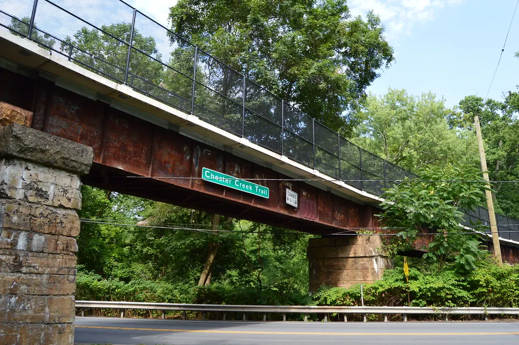
Chester Creek Trail: a Delaware County alternative
- Terrain & setting
- Paved rail trail · Delaware County
- For your walk or run
- Check current parking and access updates before travelling.
A Delaware County option for a shorter out-and-back.
Use the Knowlton Road trailhead as a starting point to investigate on the current map, rather than assuming you can park anywhere beside the trail. The site’s July 2026 news reports completion of a parking expansion, while older text lower on the page still describes construction restrictions. Use the newest notice and check again before travelling.
A short out-and-back keeps the outing adjustable. Trail extensions and access projects mean an older mileage description may not describe every currently available section.
Starting again doesn’t mean starting at your old pace
Having run in high school doesn’t make an old training routine the right place to restart. Nor does buying running shoes create an obligation to run the whole route.
If you want a structured introduction, the NHS Couch to 5K program combines walking and running and includes rest days. Read its guidance about starting safely, and get medical advice if you’re unsure whether running is appropriate for you. This local guide isn’t an individual training plan.
For a first visit, choose somewhere you can leave easily if the weather changes or you decide you’ve had enough. Walking the route first is also a useful way to learn the entrances and crossings. You can enjoy a path without measuring the outing against a previous version of yourself.
A few checks before you leave
Look at the trail manager’s current notices, the forecast and available daylight. Choose a turnaround point, carry what you need for the conditions and keep enough awareness to hear other trail users. Don’t assume fountains or restrooms will be open year-round.
If you’d rather go with other people, FOW’s guided-hike listings offer another way to explore. Read the specific walk’s terrain, pace and registration details; a guided hike is not automatically a flat beginner route.
For a date to work toward, see Philadelphia Running Events: Late 2026 Races and the 2027 Calendar. If someone in your group would rather ride, the companion Bike Riding in Philly and the Suburbs: 8 Places to Start looks at cycling options instead.
Independently researched local information, not a firsthand review of every route, medical advice or a guarantee of current access or conditions. Sources checked October 19, 2026. Follow current maps, signs and trail-manager notices.
Sources & method
Information in this guide was checked October 19, 2026. Source links appear in the text above. Dates, prices and hours can change, so confirm with the official source before you rely on them.
Photo credits and image details
These photographs were resized and converted to WebP for this website, with no crop or content changes. Source and license links are below. Dates describe the source photos, not current conditions or future events.
- SidewalkMD · CC BY-SA 4.0The Schuylkill River Trail and Center City, looking north from the South Street Bridge in October 2022. A location reference, not a current conditions report.
- Dough4872 · CC BY-SA 4.0Forbidden Drive north of Bells Mill Road, August 2026.
- Dough4872 · CC BY-SA 4.0The Montgomery County Pennypack Trail at the former Huntingdon Valley station in June 2026.
- Dough4872 · CC BY-SA 3.0Lake Galena seen from the dam at Peace Valley Park in October 2017. This landscape reference does not show every section of the lake loop.
- Dough4872 · CC BY-SA 4.0The Joseph Plumb Martin Trail in Valley Forge National Historical Park in August 2025. A route reference, not a Revolutionary Run event photo.
- Dough4872 · CC BY-SA 4.0The Chester Valley Trail north of US 202 and Saulin Boulevard in King of Prussia, October 2026. Other sections have different surroundings and crossings.
- Michael Stokes · CC BY 2.0Chester Creek Trail’s signed bridge in Delaware County, August 2018. Archival landmark view, not a trail-surface or current-access photo.